
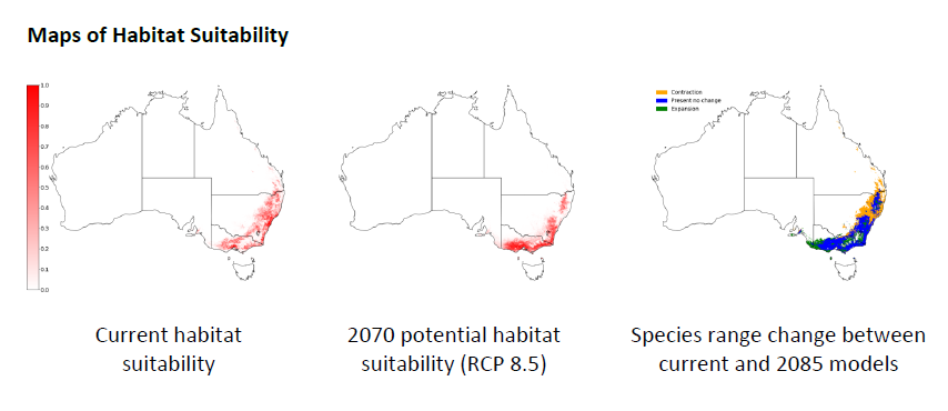
Above, the left and middle maps show the modelled habitat suitability for the species under current and potential future climate conditions. The colours indicate the predicted habitat suitability from low (white) to high (dark red). The future habitat suitability is modelled for the year 2070 under a climate change scenario that represents 'business as usual' (RCP 8.5). The map on the right shows how the range of the species might change between now and 2070, with orange areas indicating where the species might disappear, green areas where the species range might expand, and blue areas where the habitat is predicted to be suitable for the species now and in the future. The models for this species were run in the Biodiversity and Climate Change Virtual Laboratory. Please note that while models can be very informative, they are only a representation of the real world and thus should always be viewed with caution.
You can find the project summary report here.
You can read more about the science behind these models here.
![]()
The development of ClimateWatch Species Distribution Models was supported by the Inspiring Australia - Science Engagement Programme.
![]()